If you’re interested, what is the highest mountain in the UK? You’ll soon find out the answer to that and some other questions related to the features of the United Kingdom’s landscape.
The island nation of the United Kingdom of Great Britain and Northern Ireland is not a country that can boast the highest European mountain peaks.
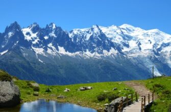
Scotland is the most mountainous region, and it is here that almost all the highest points on the map are located. Except, perhaps, for a mountain called Snowdon, the second highest mountain in the UK. Only three British mountains exceed the one-thousand-meter mark. In this article, we will tell you about the highest mountain in the UK, along with its main geological, geographical, tourist, and other data.
Ben Nevis: the Highest Mountain in the United Kingdom

So, the highest point in the UK is Ben Nevis, affectionately known as Ben. It is located on the western end of the Grampian Mountains in the Lochaber area of Scotland, not far from the small town of Fort William with a population of less than 6,000 people.
Despite its not so impressive height (you can see more detailed information in the table below), the climate on the mountain is quite severe, classified as alpine polar. Therefore, even the most accessible mountain trails require at least basic preparation and good, warm gear. Sub-zero temperatures are common on the summit for a significant part of the year.
So, let’s see what the highest mountain in the UK is like from the perspective of its history, geology, geography, and more:
| Highest Point | 1345 meters (4413 feet) |
| Origin | Volcanic |
| Parent Peak | None (highest point in the UK) |
| Translation of the ancient Gaelic name | Poisonous mountain |
| First Ascent | August 17, 1771, James Robertson |
| Isolation | 739 kilometers (the nearest higher mountain in any direction is 739 kilometers away) |
| Hiking Visitation | Over 100,000 ascents per year |
| Rock Climbing | All levels of difficulty |
The summit of Ben Nevis, a product of an extinct volcano, is a spacious, stone-strewn plateau covering an area of about 40 hectares. At the very top of the mountain, there is a stylized pyramid made of stones, about 10 feet tall, serving as a unique “reference point.”
To the north of the plateau of the highest mountain in the UK lies the world-famous North Face of Ben Nevis, and directly to the northeast is the mountain Carn Mor Dearg, connected to Ben by impressive ridges, Carn Mor Dearg Arete and Aonach Mor.
At the summit of the highest mountain in the UK, at an elevation of 1344.527 meters (4411 feet 2 inches) or 1345 meters (as indicated on the latest maps of the British Cartographic Service), above sea level, you can see the ruins of an observatory building, which was in operation from 1883 until its closure in 1904. We will come back to it shortly – don’t stop reading.
Tourist Attraction

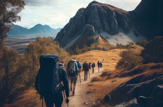
For nature lovers in general and mountain enthusiasts in particular, the highest mountain in the UK offers many enjoyable moments in both winter and summer. There are hiking trails with routes of varying difficulty, rock climbing opportunities, unforgettable views, and historical artifacts of more recent times. We’ll try to tell you a little bit about everything.
Hiking and Trekking
For fans of hiking, the highest mountain in the UK offers several options for walks and ascents of varying duration and difficulty. Let’s focus on the most interesting ones.
Main Mountain Trail, or Pony Track
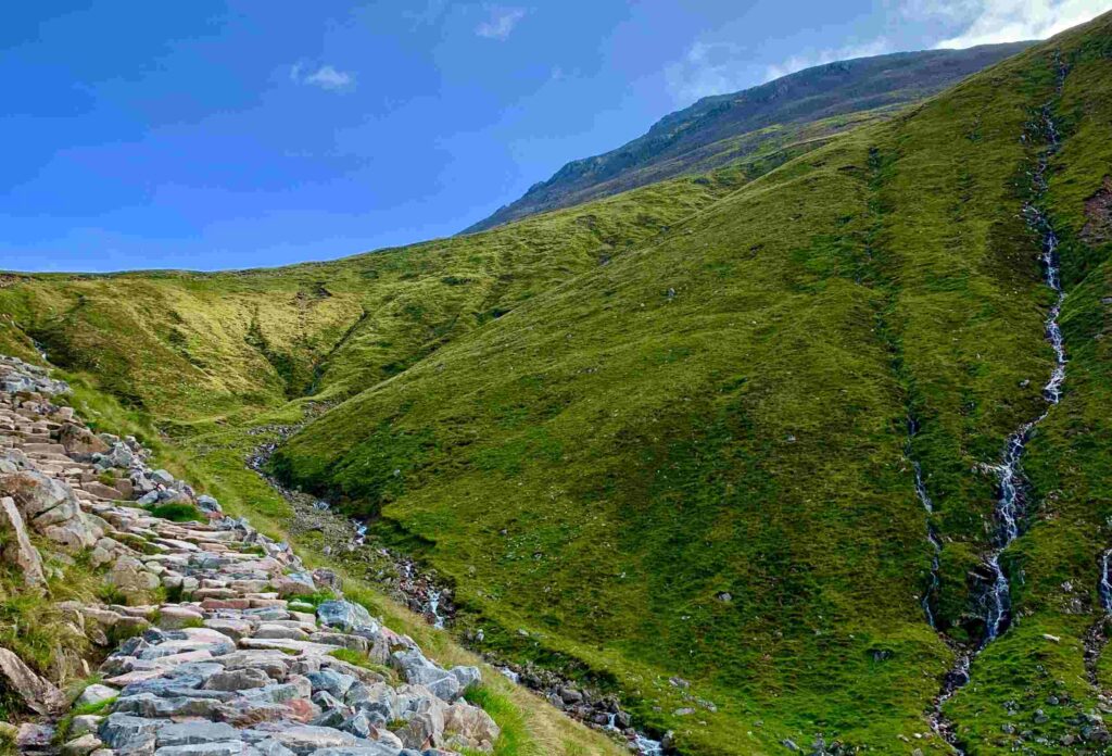
Despite being the easiest way to reach the highest point of Ben Nevis, it still requires 6 to 9 hours of walking and a certain level of physical fitness, as well as warm clothing and skills to ensure a pleasant and safe day for you.
The mountain trail, previously known as the “Tourist Route,” starts at the visitor center in Glen Nevis. The center has a lot of useful information, so it’s worth visiting before starting the ascent and talking to the staff to learn about weather updates and other important information.
The path steeply climbs through several small zigzags to the saddle at Lochan Meall and t-Suidhe at 570 meters, then ascends the remaining 700 meters up the western, rocky slope of Ben Nevis. The path consists of larger but less steep twists and turns, crossing the western side of the mountain.
The name “Pony Track” is noteworthy. In fact, this trail is not originally intended for tourists. It originally had an important practical value as an old access route to a now-ruined observatory and was designed as a narrow path for ponies carrying supplies, equipment, and other loads.
Currently, three out of four ascents to the highest mountain in Britain go through the Pony Track.
Ascending Ben Nevis via Carn Mor Dearg Arete
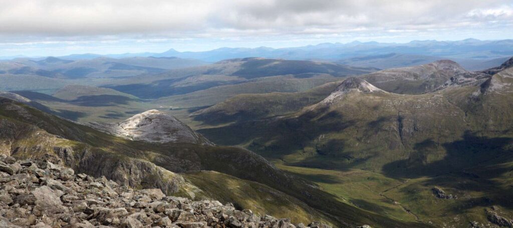
For more experienced mountaineers, there is a route that starts in the village of Torlundy, usually at the North Face car park, about four kilometers northeast of Fort William on the A82 road, and follows the path along Allt a’Mhuilinn.
The route involves a very steep climb to Carn Dearg Meadhonach, then an equally strenuous slope leads to Carn Mor Dearg (the 9th highest mountain in Scotland), and then continues along the breathtaking Carn Mor Dearg Arete ridge before steeply ascending to the summit of the mountain.
This route involves a total ascent of 1500 meters and requires basic scrambling skills, great perseverance, and a very good level of physical fitness. But the expended effort will be more than rewarded – you will get an incredibly beautiful view of the massive and impressive cliffs on the northern side of Ben Nevis, which are hidden from the main Pony Track mountain trail.
Walking Along the Glen Nevis River Trail
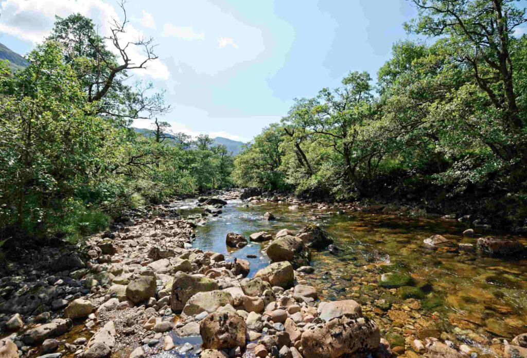
An aesthetically pleasing and non-extreme walk for those who want to “check the box” and get maximum aesthetic pleasure with minimal effort and risks.
From the visitor center, cross the river via a bridge at the far end of the car park. Follow the river upstream. In the distance, you can see Sgurr a’Mhaim, its distinctive white scree-covered slopes are often mistaken for Ben Nevis. But that’s not the case.
When you reach the bridge near the youth hostel, you can choose which way is more convenient for you to return – one-way route will be complete. For example, you can cross the bridge and continue along the pavement to the Glen Nevis restaurant, then turn left onto the road until you reach the intersection with the forest road behind the wooden houses.
Follow this road to the right until you reach the junction with the peat trail. Then continue along the path to the right through the forest until you reach the intersection with the road. The visitor center will now be across the road to your left. The second option is to cross the pass and continue uphill on a steep path to meet the Ben Nevis footpath. At this point, turn left and follow it back to the visitor center.
Rock Climbing and Ice Climbing
As for rock climbing enthusiasts, as mentioned earlier, there is an opportunity to indulge in this extreme activity at any level of difficulty, from novice to professional athlete. Rock climbers have access to the 700-meter cliffs of the north face. They are among the highest in Scotland, providing classic rock climbing and alpine climbing of all levels of difficulty for climbers. They are also the main locations in Scotland for ice climbing enthusiasts.
Ben Nevis Observatory

The ruins of the observatory at the summit of the highest mountain in the UK are one of the attractions that draw tourists, no less than the natural beauty, the challenge of the ascent, and other experiences.
The meteorological observatory on the top of Ben Nevis was proposed by the Scottish Meteorological Society (SMS) in the late 1870s when similar structures were being built worldwide to study weather at high altitudes.
During the summer of 1881, Clement Lindley Wragge climbed the mountain daily to conduct observations, earning him the nickname “Waterproof Wragge” (although there’s a play on words with his last name and the word “rag”). However, it was difficult for scientists to access the site, leading to the establishment of a permanent observatory managed by the SMS on October 17, 1883. The building was fully staffed until 1904 when the observatory unfortunately closed due to insufficient funding. The measurements taken during those twenty years still provide the most comprehensive set of weather data for mountains in the UK.
In September 1894, the scientist-inventor Wilson worked at the observatory for less than a month as a seasonal assistant to one of the permanent staff members. During this period, he witnessed several extraordinary phenomena that he later attempted to reproduce in laboratory conditions. These attempts led to the invention of the Wilson cloud chamber, which is still used today to detect ionizing radiation.
Unforgettable Beauty of Wild Nature

For many miles in every direction, Ben Nevis is surrounded by stunning natural beauty. The highest mountain in the UK rightfully boasts breathtaking landscapes, including ridges and cliffs. Various species of beautiful plants, including rare alpine flowers, thrive here. Wildlife enthusiasts can encounter birds, mammals, and insects that have adapted to this unique alpine environment and feel perfectly at home.
Conquering the Three Peaks Challenge
Ben Nevis is part of the national Three Peaks Challenge, which involves climbing the highest peaks of Scotland, England, and Wales within 24 hours. Many adventure enthusiasts take on this challenge as a test of endurance and to experience the diverse landscapes of the UK.